
Vail Real Estate Review • East Vail Single Family Homes and Duplexes
| Address | 3947 Lupine Drive #B, Vail, CO 81657 |
| Building designation | DUP-TRIPLEX — County building card |
| Bedrooms | 3 |
| Bathrooms | 2.5 |
| Square footage | 2,665 sq ft — County Heated Area |
| Floors / stories | STORIES 2.0 |
| Garage | Garage Attached Finished: 620.0 sq ft; vehicle capacity not established |
| Year built | 1980 |
| Effective year built | 1993 |
Floor areas & recorded features
| Heated Area | 2,665 sq ft |
| Live Area | 1,822 sq ft |
| Finished Basement Area | 843 sq ft |
| Basement Area | 0 sq ft |
| Fin Bsmt=To Above | 843.0 sq ft |
| Main Floor Area | 1078.0 sq ft |
| Fin Upper Story | 744.0 sq ft |
| Garage Attached Finished | 620.0 sq ft |
| Deck | 776 sq ft |
| Patio | 261.0 sq ft |
Heated area is the County figure, not an independent measurement. Main floor 1,078 plus finished upper story 744 equals 1,822 sq ft of living area; adding finished basement 843 gives 2,665 sq ft, exactly matching the displayed totals. The separate Basement Area field is 0; that does not negate the finished basement or County WALKOUT/FBM designation. The card records Deck 776 sq ft while the sketch labels WDD 776.3 sq ft. Both figures and labels are retained without assuming a rounding method. Garage, deck and patio are shown separately.
Construction & interior
| Architectural style | 2 STORY |
| Construction quality | GOOD PLUS |
| Frame | WOOD FRAME |
| Roof covering | SYNTHETIC |
| Roof structure | GABLE/HIP |
| Heating | HT WTR B/B |
| Heating fuel | GAS |
| Air conditioning | NONE |
County record details
| Assessor account | R012288 — full County record |
| Parcel number | 2101-111-02-011 |
| Legal description | Subdivision: BIGHORN 1ST ADDITION Block: 1 Lot: 2 PARCEL B |
| Recorded land area | 0.290 acres — account-level figure |
| Use / building class | RESIDENTIAL / DUP-TRIPLEX |
| Recorded units | 1 |
| Neighborhood | SW BIGHORN DUPLEX |
Notes
The County building card records 3 bedrooms, 2.5 bathrooms and 2,665 square feet of heated area. The tables provide a starting point for comparing the home’s recorded layout and features; current condition and alterations should be confirmed through a property visit and current documents.
The 2026 County notice limits characteristics to the first building. The building card records DUP-TRIPLEX and Units 1; these assessment labels do not independently establish lawful dwelling configuration, per-dwelling allocation, exclusive frontage or entrances. The account menu’s “Single Family Residence” label does not replace the building card classification. No allocation is inferred. Historical photographs and closed permit summaries do not independently establish current condition or occupancy approval.
The exposed roof permit “9 B19-0060” identifies this #B account R012288 and parcel 2101-111-02-011; it also appears under the neighboring #A account and is not evidence of #A work. All four exposed permit summaries are CLOSED, but approved plans, detailed scope and closeout documents were not exposed. Declaration DOC825S90 / reception 199245 appears in this account’s records but identifies neighboring R012287 / parcel 2101-111-02-010 in its own fields. Its contents or legal effects are not attributed to #B. Transfer/declaration entries were metadata only; underlying scans and allocation plans were unavailable. No legal-configuration or condominium-status conclusion is inferred.
Property documents & records
County residential building card
County account attachments / document viewer
Explore more East Vail real estate
Location map
View larger map / Get directions
Map centered on the County address point linked to account R012288 and parcel 2101-111-02-011, labeled 3947 Lupine Drive B. Google directions displays 3947 Lupine Drive without a unit suffix; it does not verify a #B entrance. The pin is an approximate account-linked location, not a surveyed boundary or verified residence entrance. Confirm destination and access before visiting.
Source: Eagle County building, land, complete sketch, available attachments, photographs, notices and account-linked GIS records reviewed November 1, 2026. First-building, allocation and document limitations remain qualified above. Underlying deed/declaration scans and detailed permit plans/closeouts were not exposed. County document links may require an active County session.
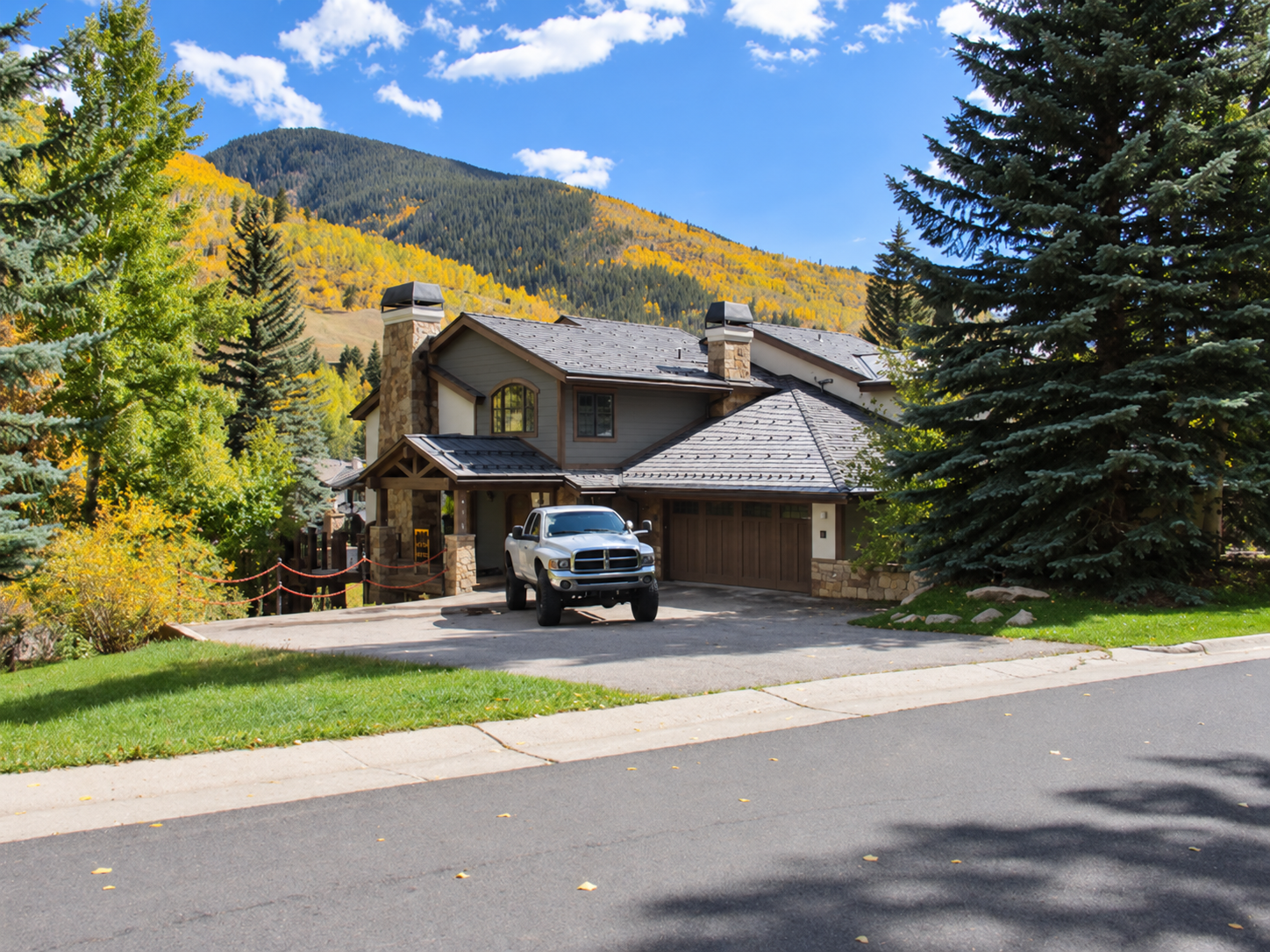
Photo: AI-assisted enhancement of a historical Eagle County exterior photograph; capture date unverified. The enhancement reconstructs roof, stone, timber, windows, garage, vegetation, paving, shadows, vehicle and small entrance-sign details. Reconstructed signage is not relied upon to identify the property or entrance. Historical imagery does not establish current condition, exclusive frontage, boundaries or entrances. View the unaltered County source photograph.

Leave a Reply