
Vail Real Estate Review • East Vail Single Family Homes and Duplexes
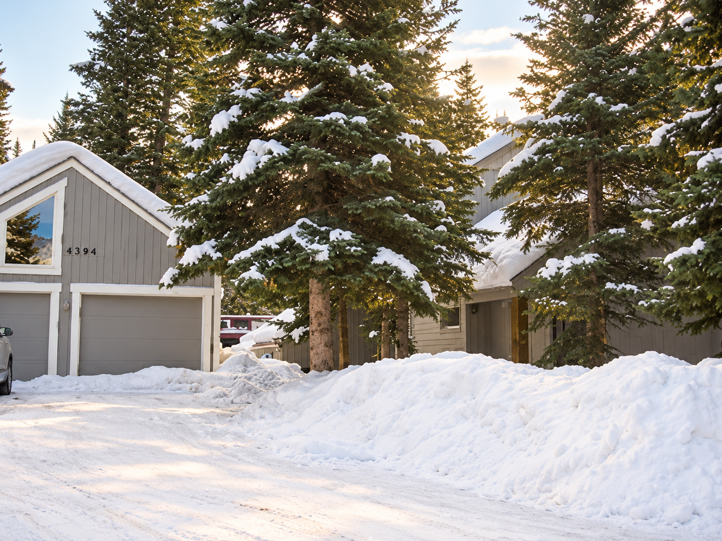
Image and source notes: The featured image is an AI-enhanced illustration based on the original County photograph, which visually matches the County photo viewer. Lighting and fine details were digitally interpreted. No capture date or visible date stamp was established; the document suffix is not a photograph date. The original shows a snowy exterior with garage doors at left and structures partly obscured by conifers. Neither image establishes current condition, interior connections, shared-use rights or exclusive West-unit ownership of every visible door or structure.
| Address | 4394 Streamside Circle W #W, Vail, CO 81657 |
| Building designation | DUP-TRIPLEX (County building type; one recorded unit) |
| Bedrooms | 4 |
| Bathrooms | 4 |
| Square footage | 2,468 sq. ft. (County heated area) |
| Floors / stories | County architectural style: 2 1/2 STY; separate Stories field: 2.0 |
| Garage | 264 sq. ft. |
| Year built | 1978 |
| Effective year built | 1987 |
Floor areas & recorded features
| Main floor | 1,672.1 sq. ft. |
| Finished upper story | 796.1 sq. ft. |
| Heated / live area | 2,468 / 2,468 sq. ft. (County displayed totals) |
| Main plus upper subareas | 2,468.2 sq. ft. (sum of displayed decimal subareas) |
| Basement / finished basement | 0 / 0 sq. ft.; Basement Finish: NO BASEMENT |
| Garage subarea | GARAGE DETACHED FINISHED: 264.0 sq. ft. (County label) |
| Patio | 93.0 sq. ft. |
| Deck | 531.4 sq. ft. |
| County actual / footprint / effective area | 3,357 / 3,357 / 2,584 sq. ft. (separate assessor fields) |
The County displays heated and live area as 2,468 square feet; the main-floor and finished-upper-story figures add to 2,468.2 square feet. Garage, patio and deck subareas are separate and are not added to heated living area. The County labels the garage subarea GARAGE DETACHED FINISHED; that record label does not establish present physical connections, car capacity, or exclusive ownership of visible structures.
Construction & interior
| Architectural style / quality | 2 1/2 STY / GOOD (County fields) |
| Separate Stories field | STORIES 2.0 (County optional attribute) |
| Frame | NONE (literal County record value; not a finding that the building has no structural frame) |
| Exterior walls | WD SID AVG 100% |
| Roof covering / structure | ASP SHINGL / GABLE/HIP |
| Heating / fuel | FORCED AIR / gas |
| Air conditioning | NONE (County record value; current equipment not independently verified) |
| Interior walls | DRYWALL 100% |
| Floor finishes | HARDWOOD 40% / CARPET INV 60% |
| Rooms / fixtures | 8 / 18 |
| Room Height / Wall Finish | Blank in the inspected County fields |
| Garage attribute / Carport Garage field | GARAGE 001-350 / 0 (separate County fields) |
County record details
| Assessor account | R010907: full County record |
| County situs | 4394 STREAMSIDE CIR #W |
| Parcel number | 2101-123-05-005 |
| Legal description | Subdivision: BIGHORN 4TH ADDITION Lot: 9 PARCEL 1, 2 & 1/2 PARCEL 5 |
| Recorded land area | 0.273 acres (account-level figure) |
| Building type / units | DUP-TRIPLEX / 1 |
| Use / local code | RESIDENTIAL / DUP/TRIPLEX |
| County heading / abstract | Single Family Residence / SINGLE FAM.RES-IMPROVEMTS (administrative classifications; distinct from the DUP-TRIPLEX building type) |
| Land classification | SINGLE FAM.RES.-LAND; 100% |
| Neighborhood / super-neighborhood | BIGHORN ALONG HIGHWAY 6 / EAST VAIL / BOOTH FALLS |
| Other land fields | SQFT / Units: 0 / 0; LAND_IND: A; Unit Type: 4; Land Code: BIGHORN HWY 6; Size: 0.273 with no separate units displayed |
| Land use / GRFA / Creek | RESIDENTIAL / 3810 / 115 (Creek units not stated; these fields do not establish development entitlement or measured frontage) |
| View fields / building public remarks | Blank in the inspected County record |
Notes
Vail Real Estate Review: The West account records one residential unit with four bedrooms, four bathrooms and 2,468 heated square feet. Its building type is DUP-TRIPLEX, while the card heading and abstract use Single Family Residence classifications. These are distinct County fields, not a basis for treating the residence as a separately verified single-family structure.
The County records architectural style 2 1/2 STY and a separate Stories value of 2.0. Both are retained here rather than choosing one description. The garage is a separately recorded 264.0-square-foot GARAGE DETACHED FINISHED subarea, with deck and patio areas also listed separately. These records do not establish current finishes, room connections, shared-use rights or exclusive ownership of structures visible in the photograph.
The indexed Vail remodel permits B10-0266 and B09-0003 are marked CLOSED. This is the recorded permit status, not independent confirmation of completed work, final inspection or present condition. The underlying plat and declaration instruments were not inspected, so no boundary, allocation or declaration-rights conclusions are drawn.
Property documents & records
County account and document index
Detailed residential building card; County land record
County permit card B10-0266: VAIL; REMODEL; issued August 30, 2010; recorded value $21,000; status CLOSED.
County permit card B09-0003: VAIL; REMODEL; issued January 13, 2009; recorded value $51,000; status CLOSED.
CLOSED is the County card status. It does not independently verify completed work, final inspection, code compliance or present condition.
County indexed plat: record details: document date November 14, 1978; book 0278, page 0507.
County indexed declaration: record details: document date November 16, 1978; book 0278, page 0600.
These links are County index/card entries, not a review of the underlying recorded instruments. The inspected permit and document cards identify R010907 / 210112305005. The plat and declaration cards have blank reception numbers, sale dates and remarks, with sale price displayed as 0; these fields do not establish a zero-price transfer. No boundary, allocation, easement, shared-use or declaration-rights conclusions are drawn.
Location map
View larger map / Get directions
Map centered on the official County GIS address point, feature 4130, identified as 4394 STREAMSIDE CIR W W / R010907 / 210112305005. Its selected one-point GeoJSON export gives longitude -106.2958276495493 and latitude 39.63516431932962, rounded here to 39.6351643, -106.2958276. No explicit CRS member appeared; longitude/latitude interpretation follows GeoJSON convention. This address-reference point is not a surveyed boundary, verified entrance or access route, or proof of an exclusive-use area.
Response
[…] View fact sheet […]